Submarine Ship Control And Navigation Systems Parts

(Page 11) End item NSN parts page 11 of 24
Part Number
NSN
NIIN
118270-1 Circuit Breaker
008769216
1185-6CN0562 Screw Thread Insert
002904518
1185-6CN562 Screw Thread Insert
002904518
1190 Electrical Contact
006263538
1190T Electrical Contact
006263538
1197004D713-5 Electrical Power Cable Assembly
012336584
12-890824-001 Electronic Test Extender Card
010875684
120-98-00003 Cartridge Fuse
000106652
1201 Electrical Power Cable Assembly
008121313
121671 Annular Ball Bearing
006796786
121G3359-1-1 Transistor
004997251
12277 Electronic Equipment Parts Kit
004411688
122918 Air Conditioning Filter Element
008378196
123-5901612 PART 93 Nonelectrical Wire
005541678
123478-L10 Hexagon Head Cap Screw
001159526
124-0354 Diode Semiconductor Device
001753767
124772-072 Air Conditioning Filter Element
008378196
1251-5296 Electrical Contact
006263538
12552994 Single Leg Wire Rope Assembly
001288860
1259-010PC1 Liquid Sight Indicator
011445907
Page: 11 ...

Submarine Ship Control And Navigation Systems

Picture of Submarine Ship Control And Navigation Systems

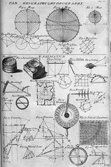
Navigation is a field of study that focuses on the process of monitoring and controlling the movement of a craft or vehicle from one place to another.

It is also the term of art used for the specialized knowledge used by navigators to perform navigation tasks. All navigational techniques involve locating the navigator's position compared to known locations or patterns.

Navigation, in a broader sense, can refer to any skill or study that involves the determination of position and direction. For information about different navigation strategies that people use, visit human navigation.

In the European medieval period, navigation was considered part of the set of seven mechanical arts, none of which were used for long voyages across open ocean. Polynesian navigation is probably the earliest form of open ocean navigation, it was based on memory and observation recorded on scientific instruments like the Marshall Islands Stick Charts of Ocean Swells. Early Pacific Polynesians used the motion of stars, weather, the position of certain wildlife species, or the size of waves to find the path from one island to another.

Compare Now »
Clear | Hide