Submarine Ship Control And Navigation Systems Parts

(Page 6) End item NSN parts page 6 of 24
Part Number
NSN
NIIN
1 1-4IN TYPEM C Fluid Filter
012031248
1-0003-0103-68 Composition Fixed Resistor
002285506
10-214128-06P Electrical Plug Connector
009430351
10-214216-6H Electrical Plug Connector
011321782
10-214220-27PX Electrical Receptacle Connector
004361376
10-214236-10S Electrical Receptacle Connector
000183492
10-214618-19 Electrical Plug Connector
008567782
10-214618-1G Electrical Plug Connector
008567782
10-214622-22J Electrical Plug Connector
007719166
10-214624-9S Electrical Plug Connector
009173340
10-214920-27S Electrical Plug Connector
012593639
10-3342-3 Electrical Contact Assembly
000139783
10-497007-163 Electrical Contact
010453132
10-497007-165 Electrical Contact
010453132
10-6439 Toggle Switch
006443039
100-007-100 Composition Fixed Resistor
001048343
100-1018S Electrical Contact
008089793
100-1018S1 Electrical Contact
008089793
1000-0170 Cartridge Fuse
000106652
1000-1228-0001 Tip Jack
006551326
Page: 6 ...

Submarine Ship Control And Navigation Systems

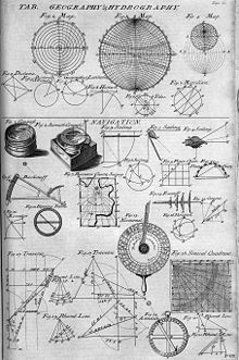
Picture of Submarine Ship Control And Navigation Systems

Navigation is a field of study that focuses on the process of monitoring and controlling the movement of a craft or vehicle from one place to another.

It is also the term of art used for the specialized knowledge used by navigators to perform navigation tasks. All navigational techniques involve locating the navigator's position compared to known locations or patterns.

Navigation, in a broader sense, can refer to any skill or study that involves the determination of position and direction. For information about different navigation strategies that people use, visit human navigation.

In the European medieval period, navigation was considered part of the set of seven mechanical arts, none of which were used for long voyages across open ocean. Polynesian navigation is probably the earliest form of open ocean navigation, it was based on memory and observation recorded on scientific instruments like the Marshall Islands Stick Charts of Ocean Swells. Early Pacific Polynesians used the motion of stars, weather, the position of certain wildlife species, or the size of waves to find the path from one island to another.

Compare Now »
Clear | Hide