Submarine Ship Control And Navigation Systems Parts

(Page 4) End item NSN parts page 4 of 24
Part Number
NSN
NIIN
03902-04-A4-A09-07 Indicator Panel
014508655
04-4674164 Wiper Ring
000075407
041-538 Composition Fixed Resistor
002285506
0416434-0303 Cartridge Fuse
000106652
04271-0590-01 Electrical Contact
006263538
04610002-005 Incandescent Lamp
002287130
046153-0001 Diode Semiconductor Device
008366667
049388 Fluid Filter Element
000526592
049478 Fluid Filter Element
000526592
05-01-0017 Electrode Assembly
006590677
057-0687-002 Electrical Connector Cable Clamp
013082987
06-17-0539 Electrical Plug Connector
010864961
06-17-0813 Electrical Plug Connector
011769789
06-46-4101 Electrical Plug Connector
008567782
06-99-0073 Electrical Connector Assembly
000648546
06-99-0074 Electrical Plug Connector
008754573
060-01002-063 Composition Fixed Resistor
001048343
060-02006-041 Composition Fixed Resistor
001367103
060-06204-041 Composition Fixed Resistor
002285506
0616-028PC5 Packing Assembly
008399973
Page: 4 ...

Submarine Ship Control And Navigation Systems

Picture of Submarine Ship Control And Navigation Systems

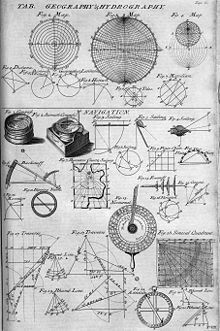
Navigation is a field of study that focuses on the process of monitoring and controlling the movement of a craft or vehicle from one place to another.

It is also the term of art used for the specialized knowledge used by navigators to perform navigation tasks. All navigational techniques involve locating the navigator's position compared to known locations or patterns.

Navigation, in a broader sense, can refer to any skill or study that involves the determination of position and direction. For information about different navigation strategies that people use, visit human navigation.

In the European medieval period, navigation was considered part of the set of seven mechanical arts, none of which were used for long voyages across open ocean. Polynesian navigation is probably the earliest form of open ocean navigation, it was based on memory and observation recorded on scientific instruments like the Marshall Islands Stick Charts of Ocean Swells. Early Pacific Polynesians used the motion of stars, weather, the position of certain wildlife species, or the size of waves to find the path from one island to another.

Compare Now »
Clear | Hide